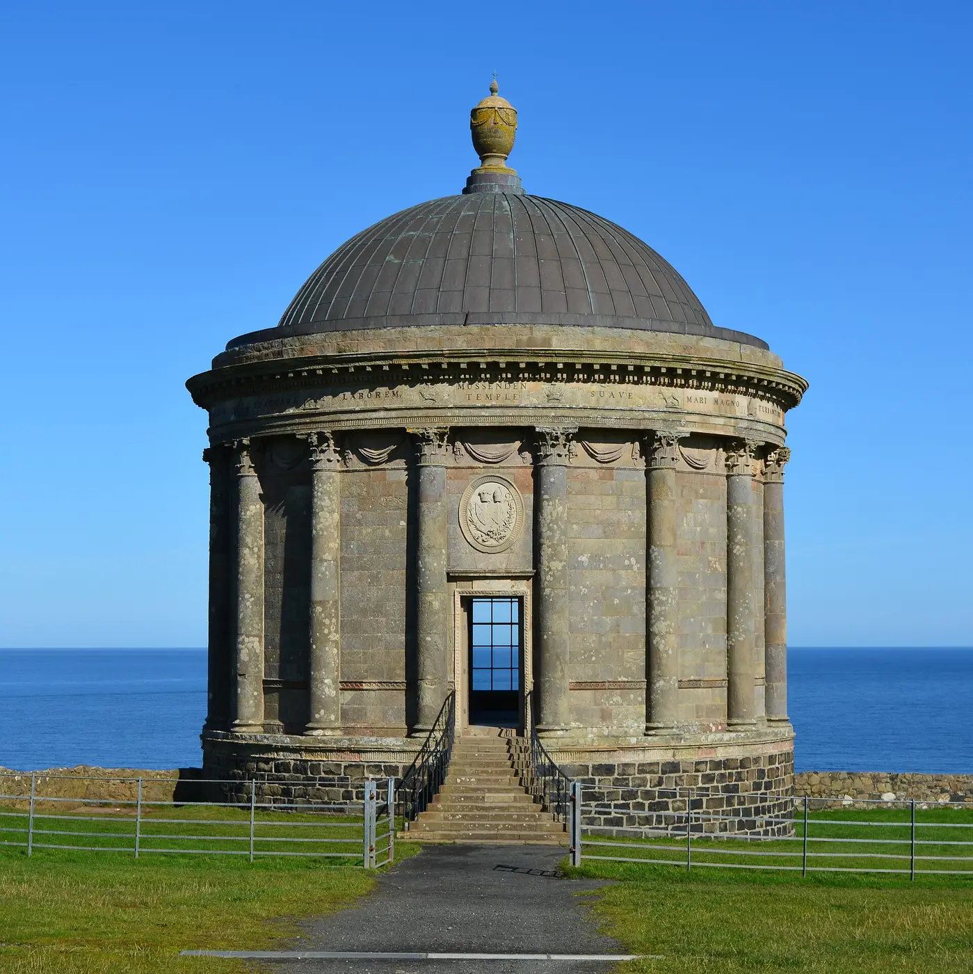
County Derry / Londonderry
“DIRR-a” · oak grove, from doire, an oak wood
Known as The Oak Leaf County. Straight from the name: Doire is an oak grove, and the city is Doire Cholm Cille, Colmcille's oak wood. The oak leaf is on the county crest.
A fact like this for every county and every age →
Compare with another county → · Printable one-page summary →
Mount Sandel, near Coleraine, is perhaps the oldest recorded settlement in Ireland, and the county has a rich prehistoric landscape at Ballygroll and elsewhere. In the Middle Ages this was O'Cahan's country, tributary to the O'Neills, and late in Elizabeth I's reign it was seized and made the county of Coleraine.
On 2 March 1613 James I granted a charter to the Irish Society, formed by the twelve great livery companies of London, to plant a new county. It was named Londonderry and was built from County Coleraine plus most of the barony of Loughinsholin from Tyrone (for its timber), a strip of Antrim, and the city of Derry and its liberties from Donegal, so the Society could hold both banks of the Foyle and the Bann. Each company got an estate of about 3,210 acres, and several of the county's towns grew from their halls — the Drapers at Moneymore, the Salters at Magherafelt, the Skinners at Dungiven, the Vintners at Bellaghy, among others.
Under the Local Government Act of 1898 the city was separated from the county, and Coleraine became the county town until the county council was abolished in 1973.
Drawn from the History section of the Wikipedia article on County Derry / Londonderry ↗, rewritten here and adding nothing it does not say; licensed CC BY-SA 4.0. The chronology above is this site's own; where the two differ, the article is the one to check.
The highest point in the county is the summit of Sawel Mountain on the border with County Tyrone. Sawel is part of the Sperrin Mountains, which dominate the southern part of the county. To the east and west, the land falls into the valleys of the Bann and Foyle rivers respectively; in the south-east, the county touches the shore of Lough Neagh, which is the largest lake in Ireland; the north of the county is distinguished by the steep cliffs, dune systems, and remarkable beaches of the Atlantic coast.
Places of interestThe highest point in the county is the summit of Sawel Mountain on the border with County Tyrone. Sawel is part of the Sperrin Mountains, which dominate the southern part of the county. To the east and west, the land falls into the valleys of the Bann and Foyle rivers respectively; in the south-east, the county touches the shore of Lough Neagh, which is the largest lake in Ireland; the north of the county is distinguished by the steep cliffs, dune systems, and remarkable beaches of the Atlantic coast.
Read the full article ↗ · Text from Wikipedia, licensed CC BY-SA 4.0.
Tap a name for its full page — story, homeland map and neighbours. Or see all surnames from County Derry / Londonderry, with the other counties each name is tied to.
Towns. Derry Doire (84,884, 2021), Coleraine Cúil Raithin (24,560, 2021), Limavady Léim an Mhadaidh (11,697, 2021), Maghera Machaire Rátha (4,222, 2021). What every town name means →
Saints. St Colmcille (9 June).
Legends set here. Banagher — the lucky sand. On the atlas →
At the 2021 census, 20,044 people in Derry / Londonderry aged 3 and over said they could speak Irish, and 11,653 could speak, read, write and understand it. 6,833 speak it daily, and for 827 it is their main language.
NISRA, Census 2021, Flexible Table Builder (county geography, built by NISRA from Data Zones; Belfast is split between Antrim and Down). All six counties →
Sawel (Samhail), 678 metres, in the Sperrin Mountains, on the county boundary and shared with a neighbouring county.
Rivers and loughs: River Bann, River Foyle, Lough Neagh.
MountainViews, via Wikipedia. Every county's highest point → · Rivers and loughs →
Hurling: no senior title.
Football: 1 senior title (1993); 1 final lost.
-
Seamus Heaney ↗
· 1939–2013
Irish poet, playwright, translator, lecturer, born at Castledawson -
Harry Gregg ↗
Northern Irish footballer and manager, born at Magherafelt -
Peter Doherty ↗
· 1913–1990
Northern Irish footballer, born at Magherafelt -
Robert Caldwell ↗
British orientalist and dravidologist, born at Clady -
William Ogilby ↗
Irish zoologist -
Henry McCullough ↗
· 1943–2016
British musician, born at Portstewart -
Charles Thomson ↗
· 1729–1824
American patriot leader, born at Maghera -
John Mitchel ↗
· 1815–1875
Irish politician -
George White ↗
· 1835–1912
British Army officer, born at Portstewart -
Kevin Lynch ↗
· 1956–1981
Irish hunger striker, born at Park -
David Baird Sr. ↗
· 1839–1927
American politician -
Adam Clarke ↗
· 1762–1832
British theologian, born at Moybeg Kirley -
James Chichester-Clark ↗
· 1923–2002
British politician, Prime Minister of Northern Ireland -
Fred Catherwood ↗
· 1925–2014
British politician, born at Castledawson -
Eve Bunting ↗
· 1928–2023
American children's writer, born at Maghera -
Thomas Graves ↗
· 1747–1814
Royal Navy admiral -
Harriet Russell Morison ↗
· 1862–1925
New Zealand tailor, trade unionist, suffragist and public servant, born at Magherafelt -
John Boyd ↗
· 1826–1893
Lieutenant Governor of New Brunswick, born at Magherafelt -
John Rhea ↗
· 1753–1832
American politician -
Helena Concannon ↗
· 1878–1952
Irish politician, born at Maghera -
Kitty Wilkinson ↗
Baths superintendent -
Francis Lagan ↗
· 1934–2020
Irish Roman Catholic bishop, born at Maghera -
Helen Sophia O'Hara ↗
· 1846–1920
Irish watercolour artist, born at Portstewart -
Noël Henderson ↗
· 1928–1997
Irish rugby union player, born at Drumahoe -
Brian Keenan ↗
· 1941–2008
Irish republican, born at Draperstown -
Charles Donagh Maginnis ↗
· 1867–1955
Irish architect -
Jim McCabe ↗
· 1918–1989
Association football player, born at Draperstown -
Norah McGuinness ↗
· 1901–1980
Irish artist -
John Tohill ↗
· 1855–1914
Catholic bishop, born at Kilrea -
Matilda Heron ↗
· 1830–1877
American actress
From Wikidata: people whose recorded birthplace is in the county, who have a Wikipedia article and are no longer living, with dates shown only where the article confirms them, ordered by how many languages Wikipedia covers them in. Traditional birthplaces of early saints are as Wikidata records them. Dates are left off where the sources disagree.
Derry / Londonderry had 222,174 people in 1841 and has 252,231 now (+14%). its low point 139,693 in 1926, -37% of 1841. It is one of the counties that has recovered its pre-Famine population.
| 1821 | 1831 | 1841 | 1851 | 1861 | 1871 | 1881 | 1891 | 1901 | 1911 | 1926 | 1937 | 1951 | 1961 | 1966 | 1971 | 1981 | 1991 | 2001 | 2011 | 2021 |
|---|---|---|---|---|---|---|---|---|---|---|---|---|---|---|---|---|---|---|---|---|
| 193,869 | 222,012 | 222,174 | 192,022 | 184,209 | 173,906 | 164,991 | 152,009 | 144,404 | 140,625 | 139,693 | 142,736 | 155,540 | 165,298 | 174,658 | 183,094 | 197,278 | 213,035 | 235,864 | 247,132 | 252,231 |
Census returns as tabulated in the county's Wikipedia article. All 32 counties, 1821 to today →
- Aughlish · stone circle
- Corick · stone circle
- Derry · round tower · incomplete · 5.5 m
- 5 castles · Bellaghy Bawn, Coleraine Castle, Dungiven Castle, Limavady Castle, Low Rock Castle
Every pin is placed by its documented coordinates. All the monuments of Ireland →
Everything on the site about County Derry / Londonderry
The county
History
Monuments and heritage
Coast and country
People and culture
What is the Irish name for County Derry / Londonderry?
Doire. Derry / Londonderry is one of the 9 counties of Ulster (Cúige Uladh).
Who ruled County Derry / Londonderry in the Middle Ages?
Around 1014 it was held by Tír Eoghain (Mac Lochlainn / O'Neill); by 1450, O'Neill of Tír Eoghain. The full era-by-era chronology is on this page.
What surnames come from County Derry / Londonderry?
Names historically associated with Derry / Londonderry include Bradley, Branagan, Cormack, Craig, Devlin, Diamond, Doherty, Gilligan, among others.
What does Doire mean?
Doire, said “DIRR-a”, means oak grove — from doire, an oak wood. Doire Cholm Cille, Colmcille's oak grove. London was added to the charter of 1613; the Irish name never took it, and the county has two English names to this day.
What is the population of County Derry / Londonderry?
252,231 at the 2021 census, against 222,174 in 1841, before the Famine.
What is the county town of Derry / Londonderry?
Coleraine. County Derry / Londonderry covers about 2,118 km², which makes it the 15th largest of the 32 counties.
Who are famous people from County Derry / Londonderry?
Among the best-known people born in Derry / Londonderry are Seamus Heaney, Harry Gregg, Peter Doherty, Robert Caldwell, William Ogilby, Henry McCullough. The full list, with their birthplaces, is on this page.
What did the Famine do to County Derry / Londonderry?
The census counted 222,174 people in Derry / Londonderry in 1841 and 192,022 in 1851: a change of -14% in ten years, through death and emigration.
A clean copy for school projects or the family file; collapsed sections print in full.
- Wikipedia — County Londonderry ↗
- CSO — Census of Population 2022 ↗
- NISRA — Census 2021 ↗
- Wikipedia — List of Irish counties by population ↗
- 1841 census of Ireland (county table) ↗
- Historical population of Ireland (county series) ↗
- Logainm.ie — the State's Placenames Database of Ireland ↗
- Wikipedia — Counties of Ireland ↗
- Wikipedia — the county articles ↗
- Woulfe, Irish Names and Surnames (1923), for the surnames ↗
The chronology of who held the county is this site's own reading of the standard histories onto today's county borders, and says so where the fit is rough. Quoted passages are marked and licensed. Spotted an error? Say so — corrections are credited.
- 1911 Census — Londonderry ↗
- 1901 Census — Londonderry ↗
- Griffith's Valuation — search Londonderry ↗
- Down Survey maps — Londonderry ↗
- Schools' Folklore Collection — Londonderry ↗
- Placenames of Londonderry (Logainm) ↗
- PRONI records (Northern Ireland) ↗
- Placenames NI ↗
Free, from the holding institutions. How to begin: the six-step guide → · Spotted an error on this page? Suggest a correction.