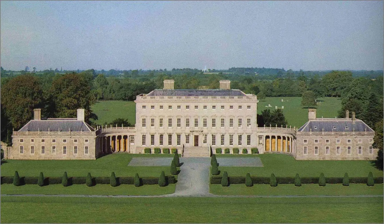
County Kildare
“kill DAR-a” · church of the oak, from cill (church) + dair (oak)
Known as The Thoroughbred County. For the Curragh and the horse country around it: the racecourse, the studs, and the flat limestone grassland that feeds them.
A fact like this for every county and every age →
Compare with another county → · Printable one-page summary →
Kildare was made a shire in 1297 and took its present borders only in 1832, when a number of detached pieces were tidied away. It was the home of the FitzGeralds, the Earls of Kildare, and parts of it lay within the Pale, the area around Dublin where English law held. The county's Wikipedia history is short; the county's saints, castles and monuments elsewhere on this page say more.
Drawn from the History section of the Wikipedia article on County Kildare ↗, rewritten here and adding nothing it does not say; licensed CC BY-SA 4.0. The chronology above is this site's own; where the two differ, the article is the one to check.
Kildare is the 24th-largest of Ireland's 32 counties in area and the seventh-largest in terms of population. It is the eighth largest of Leinster's twelve counties in size, and the second largest in terms of population. It is bordered by the counties of Carlow, Laois, Meath, Offaly, South Dublin and Wicklow. As an inland county, Kildare is generally a lowland region. The county's highest points are the foothills of the Wicklow Mountains bordering to the east. The highest point in Kildare is Cupidstown Hill on the border with South Dublin, with the better-known Hill of Allen in central Kildare.
Read the full article ↗ · Text from Wikipedia, licensed CC BY-SA 4.0.
Tap a name for its full page — story, homeland map and neighbours. Or see all surnames from County Kildare, with the other counties each name is tied to.
Towns. Naas Nás na Ríogh (26,180, 2022), Newbridge Droichead Nua (24,366, 2022), Celbridge Cill Droichid (20,601, 2022), Maynooth Maigh Nuad (17,259, 2022), Leixlip Léim an Bhradáin (16,733, 2022), Athy Baile Átha Í (11,035, 2022), Kilcock Cill Choca (8,674, 2022), Clane Claonadh (8,152, 2022), Monasterevin Mainistir Eimhín (5,307, 2022), Kilcullen Cill Chuilinn (3,815, 2022), Kildare Cill Dara. What every town name means →
Saints. St Brigid of Kildare (1 February), St Laurence O'Toole (14 November).
Legends set here. Hill of Allen — Fionn's fort. On the atlas →
First names that belong here. Bríd, Fionn, Lorcán, Gearóid, Rathnait, Connlaodh.
At the 2022 census, 95,484 people in Kildare said they could speak Irish. 2,699 speak it every day outside school, and 5,857 weekly.
8 primary schools here teach entirely through Irish (2025/26, 2,491 pupils), and 2 secondary schools.
CSO, Census 2022, table SAP2022T3T2CTY. Every county compared →
Cupidstown Hill (Cnoc Bhaile Cupid), 379 metres, in the Wicklow Mountains.
Rivers and loughs: River Barrow, River Liffey, River Boyne.
MountainViews, via Wikipedia. Every county's highest point → · Rivers and loughs →
Hurling: no senior title.
Football: 4 senior titles (1905, 1919, 1927, 1928); 5 finals lost.
-
Ernest Shackleton ↗
· 1874–1922
Anglo-Irish Antarctic explorer, born at Kilkea Castle -
Kathleen Lonsdale ↗
· 1903–1971
Irish crystallographer, born at Newbridge -
Arthur Guinness ↗
· 1725–1803
Irish brewer and the founder of the Guinness brewery business and family, born at Celbridge -
Willoughby James Hamilton ↗
· 1864–1943
Irish tennis and badminton player, born at Monasterevin -
Charles Handy ↗
· 1932–2024
Irish economist, born at Clane -
Liam O'Flynn ↗
· 1945–2018
Irish musician, born at Kill -
John de Robeck ↗
· 1862–1928
British admiral, born at Naas -
Paul Cullen ↗
· 1803–1878
Irish Catholic cardinal, born at Narraghmore -
Lord Edward FitzGerald ↗
· 1763–1798
Irish nationalist, born at Carton House -
William Francis Patrick Napier ↗
Irish soldier in the British Army and military historian, born at Celbridge -
Christopher Barton ↗
· 1927–2013
British rower, born at Celbridge -
George Pomeroy Colley ↗
· 1835–1881
British Army general, born at Rathangan -
Gerald FitzGerald, 9th Earl of Kildare ↗
· 1487–1534
Lord Deputy of Ireland, born at Maynooth -
Domhnall Ua Buachalla ↗
· 1866–1963
Irish politician, born at Maynooth -
Lorcán Ua Tuathail ↗
· 1128–1180
Roman Catholic Irish archbishop and saint, born at Castledermot -
Nonpareil Dempsey ↗
Irish-American boxer, born at Curragh -
Michèle Burke ↗
Irish-born make-up artist, born at Kildare -
Barry St. Leger ↗
British army officer -
Augustus FitzGerald, 3rd Duke of Leinster ↗
· 1791–1874
Irish peer, born at Maynooth -
Gormflaith ingen Murchada ↗
· 960–1030
Irish queen, born at Naas -
James Duggan ↗
· 1825–1899
Catholic bishop, born at Maynooth -
Clement Johnson ↗
· 1871–1908
South African cricketer, born at Carbury -
Aidan Higgins ↗
· 1927–2015
Irish novelist, born at Celbridge -
George Lyttleton Rogers ↗
· 1906–1962
Irish tennis player, born at Athy -
John M. Kelly ↗
· 1931–1991
Irish lawyer, academic and politician, born at Naas -
Molly Keane ↗
· 1904–1996
Irish writer -
Maurice FitzGerald, 6th Duke of Leinster ↗
· 1887–1922
Irish nobleman, born at Kilkea Castle -
John Devoy ↗
· 1842–1928
Irish rebel leader and journalist, born at Kill -
Richard Fanshawe ↗
Equestrian, born at Naas -
Art O'Connor ↗
· 1888–1950
Irish politician, born at Celbridge
From Wikidata: people whose recorded birthplace is in the county, who have a Wikipedia article and are no longer living, with dates shown only where the article confirms them, ordered by how many languages Wikipedia covers them in. Traditional birthplaces of early saints are as Wikidata records them. Dates are left off where the sources disagree.
Kildare had 114,488 people in 1841 and has 246,977 now (+116%). its low point 57,892 in 1936, -49% of 1841. It is one of the counties that has recovered its pre-Famine population.
| 1821 | 1831 | 1841 | 1851 | 1861 | 1871 | 1881 | 1891 | 1901 | 1911 | 1926 | 1936 | 1946 | 1951 | 1956 | 1961 | 1966 | 1971 | 1979 | 1981 | 1986 | 1991 | 1996 | 2002 | 2006 | 2011 | 2016 | 2022 |
|---|---|---|---|---|---|---|---|---|---|---|---|---|---|---|---|---|---|---|---|---|---|---|---|---|---|---|---|
| 99,065 | 108,424 | 114,488 | 95,723 | 90,946 | 83,614 | 75,804 | 70,206 | 63,566 | 66,627 | 58,028 | 57,892 | 64,849 | 66,437 | 65,915 | 64,420 | 66,404 | 71,977 | 97,185 | 104,122 | 116,247 | 122,656 | 134,992 | 163,944 | 186,335 | 210,312 | 222,504 | 246,977 |
Census returns as tabulated in the county's Wikipedia article. All 32 counties, 1821 to today →
- Castledermot · round tower · complete to cornice · 20 m
- Dún Ailinne · royal site
- Kildare · round tower · complete to cornice · 32 m
- Killashee · round tower · incomplete · 7.3 m
- Moone High Cross · high cross
- Old Kilcullen · round tower · incomplete · 11 m
- Oughter Ard · round tower · incomplete · 9.5 m
- St. John's Church, Ballymore Eustace · high cross
- Taghadoe · round tower · incomplete · 19.8 m
- 13 castles · Barretstown Castle, Carbury Castle, County Kildare, Grange Castle, Jigginstown Castle, Kildare Castle and more
Every pin is placed by its documented coordinates. All the monuments of Ireland →
Everything on the site about County Kildare
The county
History
Monuments and heritage
Coast and country
What is the Irish name for County Kildare?
Cill Dara. Kildare is one of the 12 counties of Leinster (Cúige Laighean).
Who ruled County Kildare in the Middle Ages?
Around 1014 it was held by Kingdom of Leinster (Mac Murrough); by 1450, The English Pale. The full era-by-era chronology is on this page.
What surnames come from County Kildare?
Names historically associated with Kildare include Bermingham, Carey, Cullen, Fitzgerald, Killeen, Lyons, O'Toole, Woulfe.
What does Cill Dara mean?
Cill Dara, said “kill DAR-a”, means church of the oak — from cill (church) + dair (oak). Brigid's foundation, built beside an oak she is said to have chosen herself.
What is the population of County Kildare?
246,977 at the 2022 census, against 114,488 in 1841, before the Famine.
What is the county town of Kildare?
Naas. County Kildare covers about 1,695 km², which makes it the 24th largest of the 32 counties.
Who are famous people from County Kildare?
Among the best-known people born in Kildare are Ernest Shackleton, Kathleen Lonsdale, Arthur Guinness, Willoughby James Hamilton, Charles Handy, Liam O'Flynn. The full list, with their birthplaces, is on this page.
What did the Famine do to County Kildare?
The census counted 114,488 people in Kildare in 1841 and 95,000 in 1851 (the 1851 figure is approximate): a change of -17% in ten years, through death and emigration.
A clean copy for school projects or the family file; collapsed sections print in full.
- Wikipedia — County Kildare ↗
- CSO — Census of Population 2022 ↗
- NISRA — Census 2021 ↗
- Wikipedia — List of Irish counties by population ↗
- 1841 census of Ireland (county table) ↗
- Historical population of Ireland (county series) ↗
- Logainm.ie — the State's Placenames Database of Ireland ↗
- Wikipedia — Counties of Ireland ↗
- Wikipedia — the county articles ↗
- Woulfe, Irish Names and Surnames (1923), for the surnames ↗
The chronology of who held the county is this site's own reading of the standard histories onto today's county borders, and says so where the fit is rough. Quoted passages are marked and licensed. Spotted an error? Say so — corrections are credited.
- 1911 Census — Kildare ↗
- 1901 Census — Kildare ↗
- Griffith's Valuation — search Kildare ↗
- Down Survey maps — Kildare ↗
- Schools' Folklore Collection — Kildare ↗
- Placenames of Kildare (Logainm) ↗
Free, from the holding institutions. How to begin: the six-step guide → · Spotted an error on this page? Suggest a correction.